Log in
All resources
Create a design
4,963 Free Images of Map Pin
bibliothèque nationale de france
a map of the british empire in america with the french and spanish settlements adjacent thereto
map of the circle of austria by sanson
eran laor cartographic collection
map of the upper rhenian circle by sanson
1700s maps of austria
map of vienna by jacob hoefnagel
historical images of vienna
jacob hoefnagel
1670s maps of austria
1596 engravings
renaissance
self-published work
pages with maps
eran laor cartographic collection
ptolemy's 4th asian map
map of paris by braun & hogenberg - derivative files
porte barbette
map of vienna by jacob hoefnagel
roter turm, vienna
brazilian paintings in the museu antônio parreiras
antônio rafael pinto bandeira
historical images of graben (vienna)
map of vienna by jacob hoefnagel
old maps of arkansas in the american civil war
julius bien
application
navigation
map of the upper rhenian circle by sanson
1670s maps of hesse
map of the upper rhenian circle by sanson
1680s maps of north rhine-westphalia
map of the upper rhenian circle by sanson
1700s maps of north rhine-westphalia
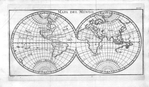
nicolas sanson. “mappe-monde, ou carte generale du monde.”
map of the bosphorus strait by guillaume sanson (1665)
grigory anikiyevich kachalov
mikhail makhaev
hoogheemraadschap rijnland map, 2nd edition, 1687
old maps of haarlem
map of maastricht by willem and johannes blaeu (1649)
first medieval city wall of maastricht
prints by romeyn de hooghe
1689 map of haarlem
early netherlandish painting
t and o map
a map of the british empire in america with the french and spanish settlements adjacent thereto
bibliothèque nationale de france
a map of the british empire in america with the french and spanish settlements adjacent thereto
bibliothèque nationale de france
a map of the british empire in america with the french and spanish settlements adjacent thereto
bibliothèque nationale de france
a map of the british empire in america with the french and spanish settlements adjacent thereto
bibliothèque nationale de france
a map of the british empire in america with the french and spanish settlements adjacent thereto
bibliothèque nationale de france
a map of the british empire in america with the french and spanish settlements adjacent thereto
bibliothèque nationale de france
a map of the british empire in america with the french and spanish settlements adjacent thereto
bibliothèque nationale de france
a map of the british empire in america with the french and spanish settlements adjacent thereto
bibliothèque nationale de france
a map of the british empire in america with the french and spanish settlements adjacent thereto
bibliothèque nationale de france
a map of the british empire in america with the french and spanish settlements adjacent thereto
bibliothèque nationale de france
a map of the british empire in america with the french and spanish settlements adjacent thereto
bibliothèque nationale de france
a map of the british empire in america with the french and spanish settlements adjacent thereto
bibliothèque nationale de france
a map of the british empire in america with the french and spanish settlements adjacent thereto
bibliothèque nationale de france
a map of the british empire in america with the french and spanish settlements adjacent thereto
bibliothèque nationale de france
a map of the british empire in america with the french and spanish settlements adjacent thereto
bibliothèque nationale de france
a map of the british empire in america with the french and spanish settlements adjacent thereto
bibliothèque nationale de france
a map of the british empire in america with the french and spanish settlements adjacent thereto
bibliothèque nationale de france
a map of the british empire in america with the french and spanish settlements adjacent thereto
bibliothèque nationale de france
a map of the british empire in america with the french and spanish settlements adjacent thereto
bibliothèque nationale de france
a map of the british empire in america with the french and spanish settlements adjacent thereto
bibliothèque nationale de france
a map of the british empire in america with the french and spanish settlements adjacent thereto
bibliothèque nationale de france
a map of the british empire in america with the french and spanish settlements adjacent thereto
bibliothèque nationale de france
a map of the british empire in america with the french and spanish settlements adjacent thereto
bibliothèque nationale de france
a map of the british empire in america with the french and spanish settlements adjacent thereto
bibliothèque nationale de france
maori culture
pin
city walls of vienna
views of vienna
map of the circle of austria by sanson
1700s maps of austria
map of the circle of austria by sanson
1670s maps of austria
map of the circle of austria by sanson
1690s maps of austria
map of the circle of austria by sanson
1670s maps of austria
map of the circle of austria by sanson
1690s maps of austria
map of the circle of austria by sanson
1690s maps of austria
map of the circle of austria by sanson
1670s maps of austria
historical images of vienna
schottenkirche, vienna
map of the circle of austria by sanson
1700s maps of austria
map of the circle of austria by sanson
1700s maps of austria
map of the circle of austria by sanson
1670s maps of austria
map of the circle of austria by sanson
1700s maps of austria
map of the circle of austria by sanson
1700s maps of austria
map of the circle of austria by sanson
1680s maps of austria
map of the upper rhenian circle by sanson
1700s maps of north rhine-westphalia
map of the circle of austria by sanson
1690s maps of austria
map of the circle of austria by sanson
1680s maps of austria
military equipment of muscovite russia
details of sigismund's map of moscow
paintings by antônio parreiras in the museu antônio parreiras
portrait paintings by antônio parreiras
prints of cartouches in the rijksmuseum amsterdam
etchings in the rijksmuseum amsterdam
french-language maps of europe
1890s maps of vienna
old submaps of paris 3e arrondissement
rue du temple (paris)
maps of paris from paris musées
baroque
map of modern syria by philippe de la rué
1650s maps of palestine
maps of paris from the david rumsey historical map collection
environs de paris levés géométriquement by jean delagrive
atlas des anciens plans de paris by imprimerie nationale, 1880 from bhvp
map of paris by françois quesnel
atlas des anciens plans de paris by imprimerie nationale, 1880 from bhvp
map of paris by françois quesnel
maps by thomas kitchin
andrew dury
city
town
france in the 1690s
old maps of france
turgot map of paris, kyoto university library – derivative files
lycée henri-iv
margraviate of moravia (1628-1782)
coats of arms on maps
brazilian paintings in the museu antônio parreiras
antônio rafael pinto bandeira
background
success
1809 maps of saxony-anhalt
1809 maps of saxony
maps in the amsterdam museum
covens en mortier
postcards of new mexico published by petley studios
curt teich postcard archives
maps in the rijksmuseum amsterdam
18th-century maps showing history
hendrik van langren map of south asia
1590s maps of iran
china veteribus sinarum regio nunc incolis tame dicta
old maps of china in harvard map collection
map of maastricht by willem and johannes blaeu (1649)
history of wyck (maastricht)
map of the german empire by louis stanislas d'arcy de la rochette
1782 maps of the holy roman empire
maps of paris from the david rumsey historical map collection
maps of île-de-france by françois de la guillotière
map of the upper rhenian circle by sanson
1690s maps of hesse
travel
maps
cartography
maps
curt teich postcard archives
maps of new mexico
henricus hondius ii, nova totius terrarum orbis geographica ac hydrographica tabula, 1630
eran laor cartographic collection
henricus hondius ii, nova totius terrarum orbis geographica ac hydrographica tabula, 1630
eran laor cartographic collection
hendrik van langren map of south asia
1590s maps of cyprus
henricus hondius ii, nova totius terrarum orbis geographica ac hydrographica tabula, 1630
eran laor cartographic collection
henricus hondius ii, nova totius terrarum orbis geographica ac hydrographica tabula, 1630
eran laor cartographic collection
old maps of china in harvard map collection
1749 maps of asia
old maps of china in harvard map collection
1749 maps of asia
map collection of leibniz-institut für länderkunde
1690s maps of the iberian peninsula
geographia universalis (1545) in the british museum
german renaissance,northern renaissance
2701 - 2800 of 4,963
Next page
/ 50